Lemosho Route Itinerary
We recommend the Lemosho route to most climber.
Day 1:
Arrive in Moshi Tanzania East Africa through kilimanjaro international airport (JRO), we will pick you at arrivals then drive to your hotel in Moshi for accommodation.
At the arrivals we will carry your name in a well printed paper so that you can easily recognize us. At the hotel is where full payment will be done, pre-climbing briefing as well as gear check.
Day 2:
Lemosho starting point to Forest Camp
Elevation (ft): 7,545 ft to 9,500ft
Distance: 6 km
Hiking Time:3-4 hours
Habitat: Rain Forest
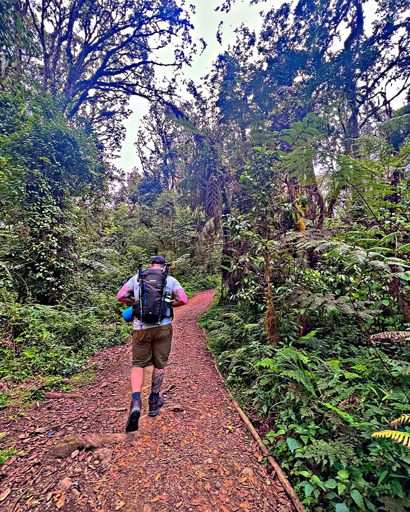
After having your nice breakfast at the hotel, we will come with a transport to pick you at 10:00 then drive to Londorossi Gate, which takes about 4 hours, where you will complete entry formalities. Then drive to the Lemosho trailhead (another hour to reach the trailhead). Upon arrival at trailhead, we eat lunch, and then commence through undisturbed forest which winds to the first camp site.
Day 3:
Forest Camp at (2,750 m) – Shira Camp 2 at (3,840 m)
Walking distance: approx. 14 km in 7-8 hours, Vegetation zone is heather and moorland
After breakfast leave Mti Mkubwa Camp, after trekking for 30 minutes the nature will transform into heather and moorland. You will cross many streams and trek over a plateau that leads to Shira 2 Camp standing at (3,840 m). The camp is next to a stream & it offers a stunning view of the Western Breach and its glaciers in the East. Arriving at the camp similar procedure will follow as per the first day. Be prepared for a cold night as temperatures drop below freezing point at this exposed camp.
Overnight at Shira 2 Camp (3,840 m).
Day 4:
Shira Camp 1 to Shira 2 Camp
Elevation: 11,800 ft to 12,500 ft
Distance: 6 km/4 miles
Hiking Time: 2 hours
Habitat: Heath
Today is a fairly easy day to help with acclimatization. We begin by exploring the grassy moorland and volcanic rock formations on the plateau. Then we take a scenic path to the Shira Cathedral, a huge buttress of rock surrounded by steep spires and pinnacles, before settling at Shira 2 Camp.
Day 5:
Shira 2 Camp to Lava Tower
Elevation: 12,500 ft to 15,190 ft
Distance: 7 km/4 miles
Hiking Time: 4-5 hours
Habitat: Alpine Desert
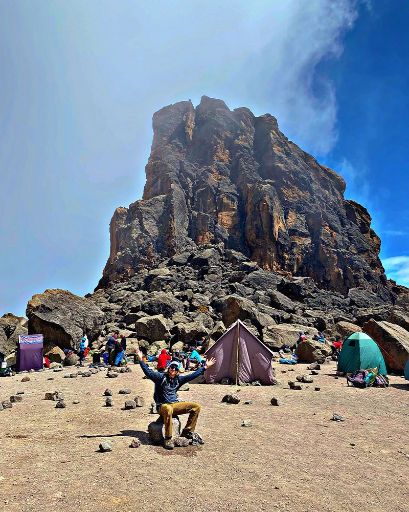
Lava Tower to Barranco Camp
Elevation: 15,190 ft to 13,044 ft
Distance: 3 km/2 miles
Hiking Time: 2-3 hours
Habitat: Alpine Desert
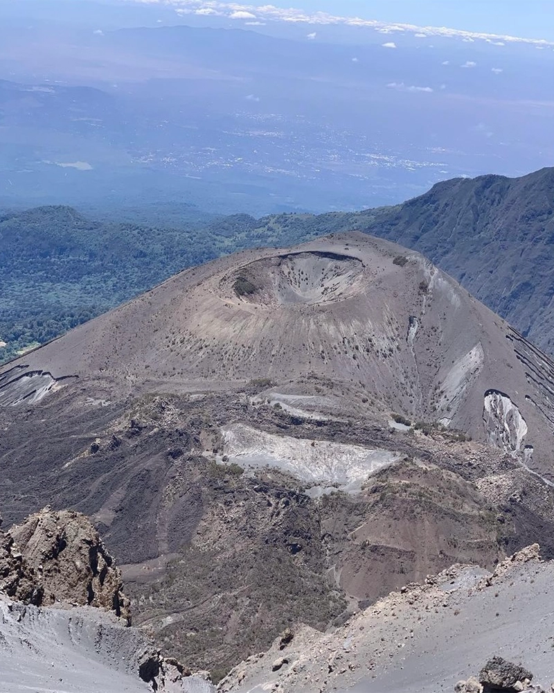
We continue to the east up a ridge and then head southeast towards the Lava Tower – a 300 ft tall volcanic rock formation. We descend down to Barranco Camp through the strange but beautiful Senecio Forest to an altitude of 13,000 ft. Although you begin and end the day at the same elevation, the time spent at higher altitude is very beneficial for acclimatization.
Day 6:
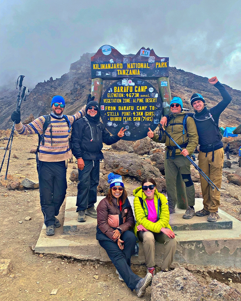
Barranco Camp to Karanga Camp to Barafu Camp
Elevation (ft): 13,000ft to 15,000ft
Distance: 9km
Hiking Time: 8-10 hours
Habitat: Alpine Desert
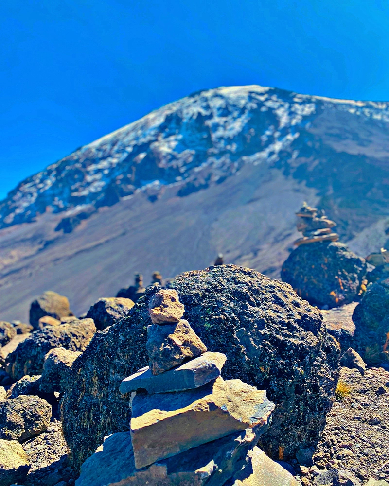
After breakfast, we leave Barranco and continue on a steep ridge passing the Barranco Wall, to the Karanga Valley campsite. Then, we leave Karanga and hit the junction which connects with the Mweka Trail. We continue up to the Barafu Hut. At this point, you have completed the South Circuit, which offers views of the summit from many different angles. Here we make camp, rest, enjoy dinner, and prepare for the summit day. The two peaks of Mawenzi and Kibo are to be seen from this position.
Day 7:
Barafu Camp to Summit to Mweka Hut
Elevation (ft): 15,300ft to 19,345ft (and down to 10,000ft)
Distance: 5 km ascent / 12 km descent
Hiking Time: 7-8 hours ascent / 4-6 hours descent
Habitat: Arctic
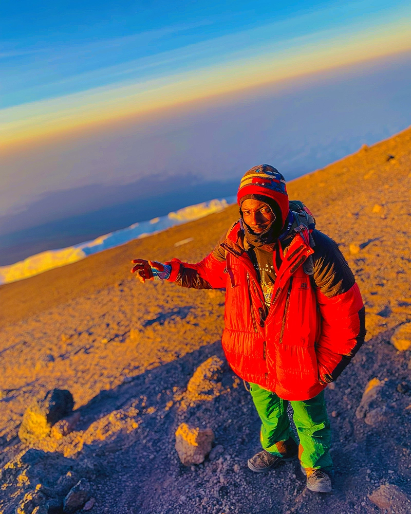
Very early in the morning (midnight), At 0:0 we start setting our pace to the summit between the Rebmann and Ratzel glaciers. You head in a northwesterly direction and ascend through heavy scree towards Stella Point on the crater rim. This is the most mentally and physically challenging portion of the trek.
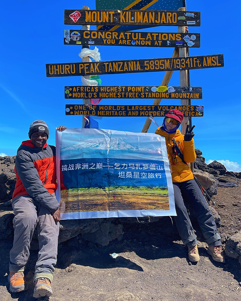
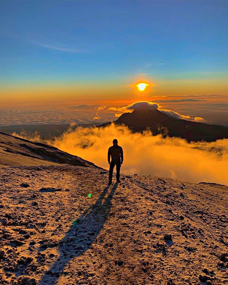
At Stella Point (18,600 ft), you will stop for a short rest and will be rewarded with the most magnificent sunrise you are ever likely to see (weather permitting). From Stella Point, you may encounter snow all they way on your 1-hour ascent to the summit. At Uhuru Peak, you have reached the highest point on Mount Kilimanjaro and the continent of Africa. Faster hikers will see the sunrise from the summit.
From the summit, we now make our descent continuing straight down to the Mweka Hut camp site, stopping at Barafu for lunch. You will want gaiters and trekking poles for the loose gravel going down. Mweka Camp is situated in the upper forest and mist or rain can be expected in the late afternoon. Later in the evening, we enjoy our last dinner on the mountain and a well-earned sleep.
Day 8:
Mweka Camp to Moshi
Elevation (ft): 10,000ft to 5,400ft
Distance: 10 km
Hiking Time: 3-4 hours
Habitat: Rain Forest
After breakfast there will be tipping ceremony where you will tip the mountain crew after the celebrations then we continue the descent down to the Mweka Park Gate to receive your summit certificates. At lower elevations, it can be wet and muddy. Gaiters and trekking poles will help. Shorts and t-shirts will probably be plenty to wear (keep rain gear and warmer clothing handy).
Our vehicle will meet you at Mweka gate to drive you back to your hotel for a hot shower, dinner and resting. We will have one stop for lunch at the souvenir shop then drive to the hotel.
Day 9:
Sadly leaving Tanzania:
If you don’t plan another tour in Tanzania you will check out your hotel then we will drive you to the airport on time to catch your flight back home.
Day 1:
Arrive in Moshi Tanzania East Africa through kilimanjaro international airport (JRO), we will pick you at arrivals on time then drive to your hotel in Moshi for accommodation.
At the arrivals we will carry your name in a well printed paper so that you can easily recognize us. At the hotel is where full payment will be done, pre-climbing briefing as well as gear check.
Day 2:
Londorossi Gate to Mtimkubwa Camp
Elevation (ft): 7,800ft to 9,500ft
Distance: 6 km
Hiking Time:3-4 hours
Habitat: Rain Forest
After having your nice breakfast at the hotel, we will come with a transport to pick you at 10:00 then drive to Londorossi Gate, which takes about 4 hours, where you will complete entry formalities. Then drive to the Lemosho trailhead (another hour to reach the trailhead). Upon arrival at trailhead, we eat lunch, and then commence through undisturbed forest which winds to the first camp site.
DAY 3:
Mti Mkubwa to Shira 1 Camp
Elevation: 9,498 ft to 11,500 ft
Distance: 8 km/ 5miles
Hiking Time 5-6 hours
Habitat: Health
We continue on the trail leading out of the rain forest and into a savannah of tall grasses, heather and volcanic rock draped with lichen beards. As we ascend through the lush rolling hills and cross several streams, we reach the Shira Ridge before dropping gently down to Shira 1 Camp. Here we catch our first glimpse of Kibo across the plateau.
DAY 4:
Shira Camp 1 to Shira 2 Camp
Elevation: 11,800 ft to 12,500 ft
Distance: 6 km/4 miles
Hiking Time: 2 hours
Habitat: Heath
Today is a fairly easy day to help with acclimatization. We begin by exploring the grassy moorland and volcanic rock formations on the plateau. Then we take a scenic path to the Shira Cathedral, a huge buttress of rock surrounded by steep spires and pinnacles, before settling at Shira 2 Camp.
DAY 5:
Shira 2 Camp to Lava Tower
Elevation: 12,500 ft to 15,190 ft
Distance: 7 km/4 miles
Hiking Time: 4-5 hours
Habitat: Alpine Desert
Lava Tower to Barranco Camp
Elevation: 15,190 ft to 13,044 ft
Distance: 3 km/2 miles
Hiking Time: 2-3 hours
Habitat: Alpine Desert
We continue to the east up a ridge and then head southeast towards the Lava Tower – a 300 ft tall volcanic rock formation. We descend down to Barranco Camp through the strange but beautiful Senecio Forest to an altitude of 13,000 ft. Although you begin and end the day at the same elevation, the time spent at higher altitude is very beneficial for acclimatization.
DAY 6:
Barranco Camp to Karanga Camp
Elevation: 13,044 ft to 13,106 ft
Distance: 5 km/3 miles
Hiking Time: 4-5 hours
Habitat: Alpine Desert
We begin the day by descending into a ravine to the base of the Great Barranco Wall. Then we climb the non-technical but steep, nearly 900 ft cliff. From the top of the Barranco Wall we cross a series of hills and valleys until we descend sharply into Karanga Valley. One more steep climb up leads us to Karanga Camp. This is a shorter day meant for acclimatization.
DAY 7:
Karanga Camp to Barafu Camp
Elevation: 13,106 ft to 15,331 ft
Distance: 4 km/2 miles
Hiking Time: 4-5 hours
Habitat: Alpine Desert
We leave Karanga and hit the junction which connects with the Mweka Trail. We continue up to the rocky section to Barafu Hut. At this point, you have completed the Southern Circuit, which offers views of the summit from many different angles. Here we make camp, rest and enjoy an early dinner to prepare for the summit day. The two peaks of Mawenzi and Kibo are viewable from this position.
DAY 8:
Barafu Camp to Uhuru Peak
Elevation: 15,331 ft to 19,341 ft
Distance: 5 km/3 miles
Hiking Time: 7-8 hours
Habitat: Arctic
Uhuru Peak to Mweka Camp
Elevation: 19,341 ft to 10,065 ft
Distance: 12 km/7 miles
Hiking Time: 4-6 hours
Habitat: Rain Forest
Very early in the morning (around midnight), at 0:0 we begin our push to the summit. This is the most mentally and physically challenging portion of the trek. The wind and cold at this elevation and time of day can be extreme. We ascend in the darkness for several hours while taking frequent, but short, breaks. Near Stella Point (18,900 ft), you will be rewarded with the most magnificent sunrise you are ever likely to see coming over Mawenzi Peak. Finally, we arrive at Uhuru Peak- the highest point on Mount Kilimanjaro and the continent of Africa.
From the summit, we now make our descent continuing straight down to the Mweka Hut camp site, stopping at Barafu for lunch. The trail is very rocky and can be quite hard on the knees; trekking poles are helpful. Mweka Camp is situated in the upper forest and mist or rain can be expected in the late afternoon. Later in the evening, we enjoy our last dinner on the mountain and a well-earned sleep.
DAY 9:
Mweka Camp to Moshi
Elevation (ft): 10,000ft to 5,400ft
Distance: 10 km
Hiking Time: 3-4 hours
Habitat: Rain Forest
After breakfast there will be tipping ceremony where you will tip the mountain crew after celebrations then we continue the descent down to the Mweka Park Gate to receive your summit certificates. At lower elevations, it can be wet and muddy. Gaiters and trekking poles will help. Shorts and t-shirts will probably be plenty to wear (keep rain gear and warmer clothing handy).
Our vehicle will meet you at Mweka gate to drive you back to your hotel in Moshi for a hot shower, dinner and resting.
Day 10:
Sadly leaving Tanzania:
If you don’t plan another tour in Tanzania you will check out at your hotel then we will drive you to the airport on time to catch your flight back home.
1). All national park fees.
2). Rescue fees.
3). Camping/Hut fees
4). Good salary for the crew.
5). All meals and clean water on the mountain.
6). A nice and comfortable mattress on the mountain
7). Tents (guest personal tent, mess tent for our guests to have their meals every day on the mountain, kitchen tent as a cooking place and to store our food, as well as shelter tent for the crew use).
8). Transport from your hotel to the mountain and back.
9). Lunch on your descending day from Kilimanjaro
10). Professional, first aided and experienced Mountain Guides, Cook and well-trained Porters to make sure your adventure with us in Tanzania is the most successful one ever!
11). Portable chemical toilet
12). Emergency Oxygen
13). First aid kit
14). Pulse oximeter to measure our guest’s heart beat and oxygen level while on the mountain
15. Airport transfers means when you arrive in Tanzania and when you are leaving Tanzania
16. Hotel staying in Moshi for two nights, a night before the trek and a night after the trek
1. Visa
2. Tips for the climbing team which is $300+ per climber
3. Highly recommended travel and medical insurance.
4. Personal hiking/trekking gear
NOTE: we are also renting nice and good quality Mt Kilimanjaro gear at our equipment store in Moshi Tanzania so you can also rent some here before the trek but if needed
5. Snacks, personal medicine and water purifying tablets
6. Meals & drinks not specified and snacks
7. Sleeping bag
8. Lunch and dinner at the hotel plus extra days at the hotel if one may need it.
9. Items of a personal nature
Note: what you are paying it covers almost all the important services you may needs here..
LEMOSHO ROUTE ITINERARY:
Lemosho route is considered the most beautiful scenery, low traffic and good for photography trail on Kilimanjaro, granting panoramic vistas on various sides of the mountain. Lemosho is a superb choice for your climb. It is our preferred route due to its high summit success rate. Most of our clients who climb Kilimanjaro using this route and in the end they report that they loved it. Thus, Lemosho is highly recommended.
The route approaches Mount Kilimanjaro from the west, beginning with a long drive of not less than two hours from Moshi to Lemosho Gate. From there, the first two days are spent trekking through the rain forest to Shira Ridge. The Lemosho route crosses the entire Shira Plateau from west to east in a pleasant, relatively flat hike. Crowds are low until the route joins the Machame route near the prominent landmark we call Lava Tower. Then the route traverses underneath Kilimanjaro’s Southern Ice Field on a path known as the Southern Circuit before summiting from Barafu. Descent is made via the Mweka route.
We offers Lemosho as a 7 or 8 day climb. The 7 day variation going from first camp to third camp without staying at second camp, this means we will skip shira one campsite.